


Rabieux canyon rocher des vierges

grageot
User
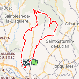

Length
19.2 km

Max alt
522 m

Uphill gradient
732 m
Km-Effort
29 km

Min alt
80 m

Downhill gradient
729 m
Boucle
Yes
Creation date :
2014-12-10 00:00:00.0
Updated on :
2014-12-10 00:00:00.0
7h34
Difficulty : Difficult

FREE GPS app for hiking
 SityTrail
IGN / Geographical institutes
SityTrail Plus
The world is yours!
About
Trail Walking of 19.2 km to be discovered at Occitania, Hérault, Saint-Guiraud. This trail is proposed by grageot.
Description
sportive dans le canyon,bartasse après les rochers des vierges suivre le GR 653 plutôt que la crête


Positioning
Country:
France
Region :
Occitania
Department/Province :
Hérault
Municipality :
Saint-Guiraud
Location:
Unknown
Start:(Dec)
Start:(UTM)
535363 ; 4835747 (31T) N.
Comments