


Reuil du 16/04/2023

VANDERPUTTENMi
User GUIDE
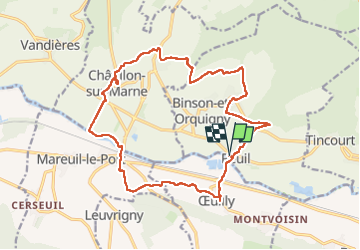

Length
18.2 km

Max alt
226 m

Uphill gradient
500 m
Km-Effort
25 km

Min alt
61 m

Downhill gradient
500 m
Boucle
Yes
Creation date :
2023-04-16 07:11:15.548
Updated on :
2023-04-16 17:48:46.177
5h39
Difficulty : Very difficult

FREE GPS app for hiking
 SityTrail
IGN / Geographical institutes
SityTrail Plus
The world is yours!
About
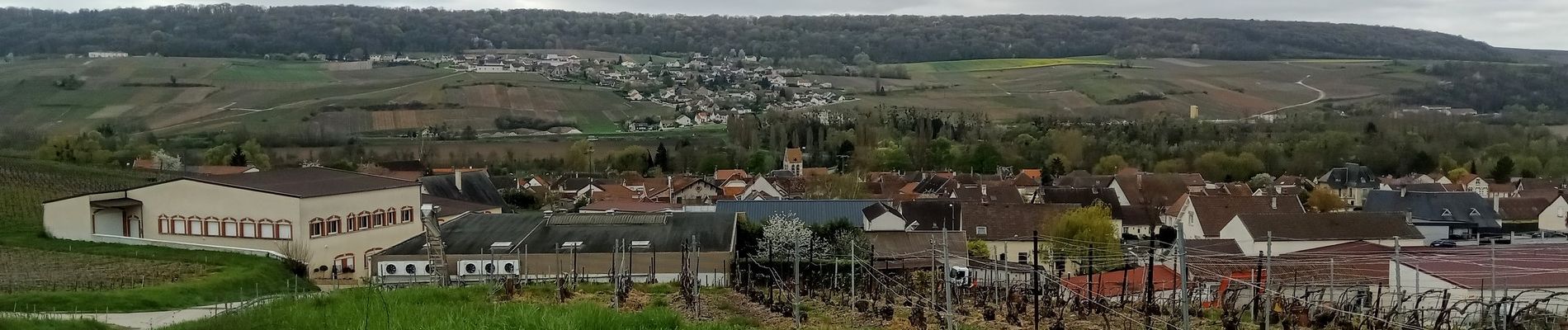
Trail Walking of 18.2 km to be discovered at Grand Est, Marne, Reuil. This trail is proposed by VANDERPUTTENMi.
Photos

Positioning
Country:
France
Region :
Grand Est
Department/Province :
Marne
Municipality :
Reuil
Location:
Unknown
Start:(Dec)
Start:(UTM)
558229 ; 5436951 (31U) N.
Comments