


Caramy version courte

affinetataille
User GUIDE
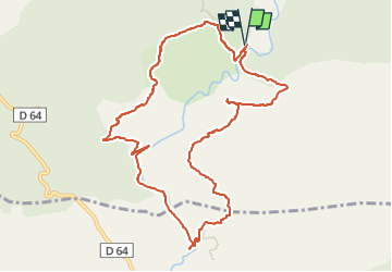

Length
11.5 km

Max alt
513 m

Uphill gradient
386 m
Km-Effort
16.7 km

Min alt
276 m

Downhill gradient
386 m
Boucle
Yes
Creation date :
2023-04-17 19:12:29.227
Updated on :
2023-04-27 20:36:46.221
5h00
Difficulty : Medium

FREE GPS app for hiking
 SityTrail
IGN / Geographical institutes
SityTrail Plus
The world is yours!
About
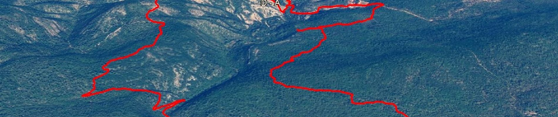
Trail Walking of 11.5 km to be discovered at Provence-Alpes-Côte d'Azur, Var, Tourves. This trail is proposed by affinetataille.
Photos


Positioning
Country:
France
Region :
Provence-Alpes-Côte d'Azur
Department/Province :
Var
Municipality :
Tourves
Location:
Unknown
Start:(Dec)
Start:(UTM)
737431 ; 4808341 (31T) N.
Comments