Trail Walking Cisternes-la-Forêt - Lavergne_Puy_Faux - Photo
 jagarnier
jagarnier

User GUIDE

© OpenStreetMap contributors
Length
Length
11.2 km
Max alt
Max alt
881 m
Uphill gradient
Uphill gradient
209 m
Km-Effort
Km-Effort  
14 km
Min alt
Min alt
718 m
Downhill gradient
Downhill gradient
210 m
Boucle
Boucle
Yes
Creation date :
2023-04-18 06:32:37.667
Updated on :
2025-06-06 10:02:52.721

(0 Reviews)

Walking
Walking
3h15
Difficulty : Medium

Scan this QR Code to open this trail in the SityTrail application

FREE GPS app for hiking

Logo SityTrail SityTrail

IGN / Geographical institutes

Download SityTrail from the App Store Download SityTrail from Google Play

Logo SityTrail SityTrail Plus

The world is yours!

Download SityTrail from the App Store Download SityTrail from Google Play Download SityTrail on Huawei AppGallery

About

Trail Walking of 11.2 km to be discovered at Auvergne-Rhône-Alpes, Puy-de-Dôme, Cisternes-la-Forêt. This trail is proposed by jagarnier.

Description

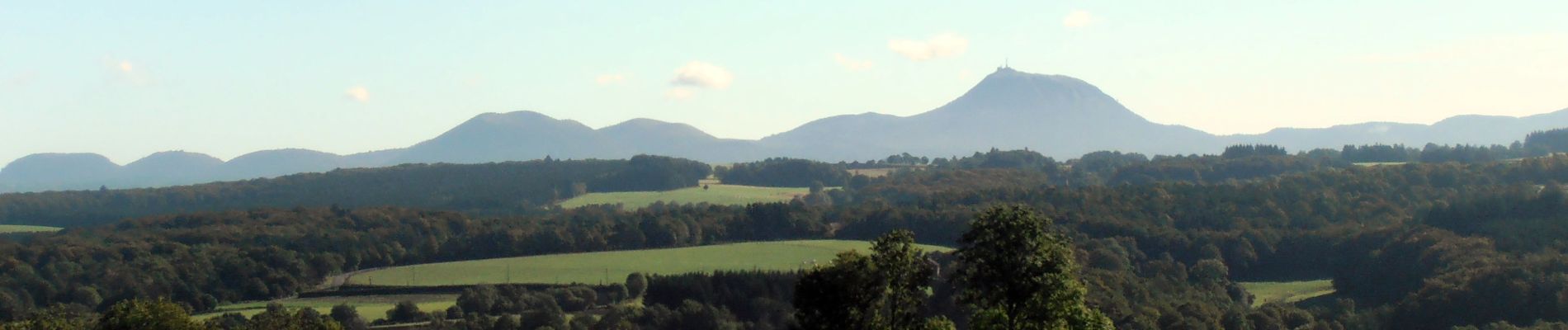
Depuis Lavergne, vous monterez sur le puy de Faux d’où vous bénéficierez de panoramas sur le massif du Sancy, la chaîne des Puys et les Combrailles. Cette randonnée serpente sur un plateau dans des décors typiques des Combrailles (ruisseaux, bois, prairies,...).

Elevation profile

Photos

Positioning

Country:
France
Region :
Auvergne-Rhône-Alpes
Department/Province :
Puy-de-Dôme
Municipality :
Cisternes-la-Forêt
Location:
Unknown
Start:(UTM)
477957 ; 5072014 (31T) N.


Close
My subscriptions