


100423 Plan de Cuques

mzonzon05
User

Length
11.7 km

Max alt
1141 m

Uphill gradient
412 m
Km-Effort
17.4 km

Min alt
700 m

Downhill gradient
476 m
Boucle
No
Creation date :
2023-04-10 14:26:43.575
Updated on :
2023-04-19 09:46:02.375
3h12
Difficulty : Difficult

FREE GPS app for hiking
 SityTrail
IGN / Geographical institutes
SityTrail Plus
The world is yours!
About
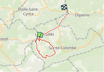
Trail Walking of 11.7 km to be discovered at Provence-Alpes-Côte d'Azur, Hautes-Alpes, Sainte-Colombe. This trail is proposed by mzonzon05.
Description
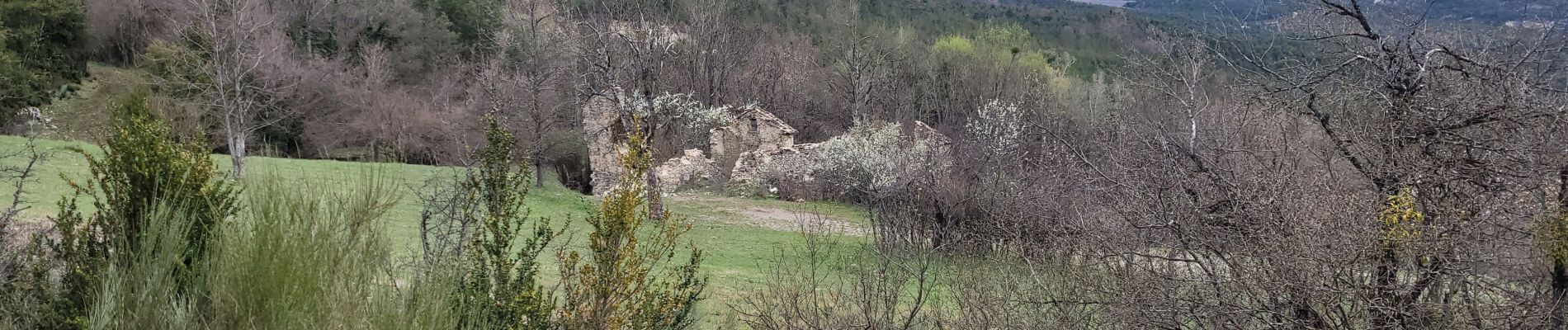
Très jolie balade variée au dessus de Ste Colombe et Plan de Cuques. Sentiers muletiers routes forestières et routes abandonnées alternent.
A faire en toute saison.
Photos

Positioning
Country:
France
Region :
Provence-Alpes-Côte d'Azur
Department/Province :
Hautes-Alpes
Municipality :
Sainte-Colombe
Location:
Unknown
Start:(Dec)
Start:(UTM)
710420 ; 4907542 (31T) N.
Comments