


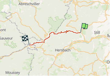
Étape 4 de la balade du chien en Alsace : d'Oberhaslach à Raon-les-Leau

Regisconraud
User

Length
25 km

Max alt
1000 m

Uphill gradient
947 m
Km-Effort
37 km

Min alt
270 m

Downhill gradient
790 m
Boucle
No
Creation date :
2023-04-20 05:58:23.551
Updated on :
2023-04-20 14:58:30.352
8h58
Difficulty : Very difficult

FREE GPS app for hiking
 SityTrail
IGN / Geographical institutes
SityTrail Plus
The world is yours!
About
Trail Walking of 25 km to be discovered at Grand Est, Bas-Rhin, Oberhaslach. This trail is proposed by Regisconraud.
Positioning
Country:
France
Region :
Grand Est
Department/Province :
Bas-Rhin
Municipality :
Oberhaslach
Location:
Unknown
Start:(Dec)
Start:(UTM)
376703 ; 5378795 (32U) N.
Comments