


st restitut

aupi
User

Length
14.6 km

Max alt
291 m

Uphill gradient
320 m
Km-Effort
18.8 km

Min alt
138 m

Downhill gradient
316 m
Boucle
Yes
Creation date :
2023-04-20 07:45:44.855
Updated on :
2023-04-21 04:54:35.483
5h54
Difficulty : Medium

FREE GPS app for hiking
 SityTrail
IGN / Geographical institutes
SityTrail Plus
The world is yours!
About
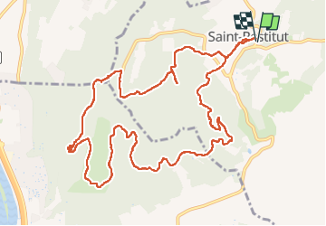
Trail Walking of 14.6 km to be discovered at Auvergne-Rhône-Alpes, Drôme, Saint-Restitut. This trail is proposed by aupi.
Positioning
Country:
France
Region :
Auvergne-Rhône-Alpes
Department/Province :
Drôme
Municipality :
Saint-Restitut
Location:
Unknown
Start:(Dec)
Start:(UTM)
642826 ; 4910198 (31T) N.
Comments