


MAINE ET LOIRE: LE GUE DE LOUET

djeepee74
User
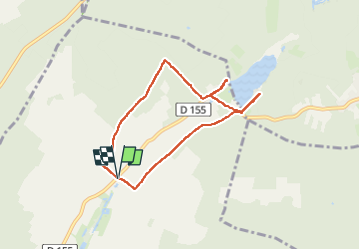

Length
6.7 km

Max alt
82 m

Uphill gradient
83 m
Km-Effort
7.8 km

Min alt
42 m

Downhill gradient
83 m
Boucle
Yes
Creation date :
2023-04-21 13:43:41.859
Updated on :
2023-04-30 17:47:12.105
1h46
Difficulty : Medium

FREE GPS app for hiking
 SityTrail
IGN / Geographical institutes
SityTrail Plus
The world is yours!
About
Trail Walking of 6.7 km to be discovered at Pays de la Loire, Maine-et-Loire, Allonnes. This trail is proposed by djeepee74.
Description
BOUCLE... live 20230421
Photos


Positioning
Country:
France
Region :
Pays de la Loire
Department/Province :
Maine-et-Loire
Municipality :
Allonnes
Location:
Unknown
Start:(Dec)
Start:(UTM)
275014 ; 5246100 (31T) N.
Comments