


2023 04 22 marseille/nogent

hal2012
User

Length
708 km

Max alt
878 m

Uphill gradient
14433 m
Km-Effort
900 km

Min alt
14 m

Downhill gradient
14412 m
Boucle
No
Creation date :
2023-04-22 14:08:28.296
Updated on :
2023-04-22 19:42:26.042
1h41
Difficulty : Very difficult

FREE GPS app for hiking
 SityTrail
IGN / Geographical institutes
SityTrail Plus
The world is yours!
About
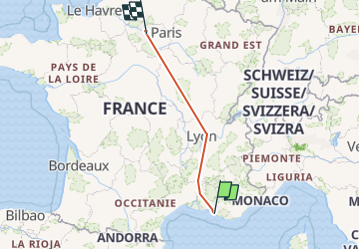
Trail Walking of 708 km to be discovered at Provence-Alpes-Côte d'Azur, Bouches-du-Rhône, Marseille. This trail is proposed by hal2012.
Positioning
Country:
France
Region :
Provence-Alpes-Côte d'Azur
Department/Province :
Bouches-du-Rhône
Municipality :
Marseille
Location:
1st Arrondissement
Start:(Dec)
Start:(UTM)
693239 ; 4797355 (31T) N.
Comments