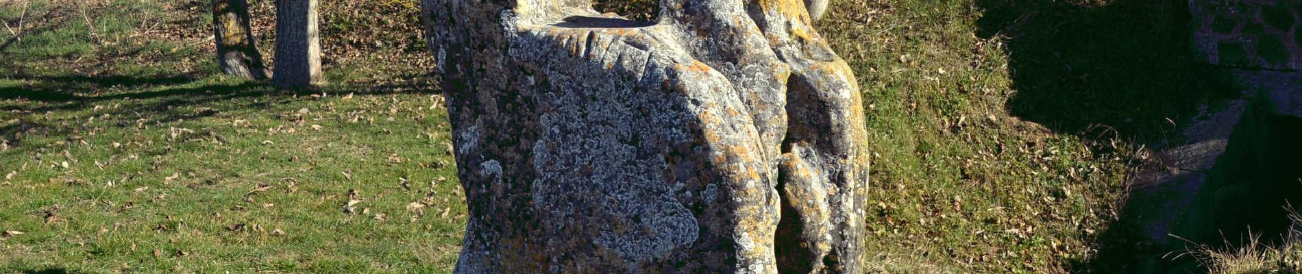
St_Genes_Retz_Pierre_Sanglante

jagarnier
User GUIDE

Length
9.6 km

Max alt
397 m

Uphill gradient
85 m
Km-Effort
10.7 km

Min alt
344 m

Downhill gradient
84 m
Boucle
Yes
Creation date :
2023-04-23 06:17:41.564
Updated on :
2024-09-25 13:26:31.996
2h45
Difficulty : Easy

FREE GPS app for hiking
 SityTrail
IGN / Geographical institutes
SityTrail Plus
The world is yours!
About
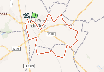
Trail Walking of 9.6 km to be discovered at Auvergne-Rhône-Alpes, Puy-de-Dôme, Saint-Genès-du-Retz. This trail is proposed by jagarnier.
Description
Randonnée sans difficulté qui offre des vues sur les monts du Forez et la chaine des Puys.
Photos

Positioning
Country:
France
Region :
Auvergne-Rhône-Alpes
Department/Province :
Puy-de-Dôme
Municipality :
Saint-Genès-du-Retz
Location:
Unknown
Start:(Dec)
Start:(UTM)
516309 ; 5101026 (31T) N.
Comments