


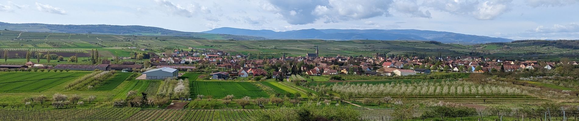
2023-04-23 Picnic CVA La Mercière depuis Westhoffen

holtzv
User GUIDE
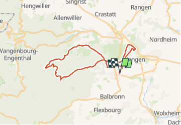


5h28
Difficulty : Medium

FREE GPS app for hiking
 SityTrail
IGN / Geographical institutes
SityTrail Plus
The world is yours!
About
Trail Horseback riding of 31 km to be discovered at Grand Est, Bas-Rhin, Westhoffen. This trail is proposed by holtzv.
Description
Boucle à la journée depuis Westhoffen pour profiter des passages ouverts offrant de belles vues sur les villages environnants ainsi que des forêts aux chemins sinueux, le tout en passant par la gloriette du Geierstein, le relais du Geisweg, la M.F. du Bischofslaeger, l’abri Schantz, et la colline du Wangenberg. Déjeuner au bistrot la Mercière à Cosswiller possédant des barres d’attaches pour le chevaux.
Photos


Positioning
Comments