


MU P23 -V1- Boucle Tête du Bostand Section 2

rsedtghijo
User
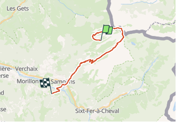

Length
20 km

Max alt
2530 m

Uphill gradient
1078 m
Km-Effort
38 km

Min alt
698 m

Downhill gradient
2021 m
Boucle
No
Creation date :
2023-04-26 18:26:56.978
Updated on :
2023-04-26 18:30:09.742
8h33
Difficulty : Very difficult

FREE GPS app for hiking
 SityTrail
IGN / Geographical institutes
SityTrail Plus
The world is yours!
About
Trail Walking of 20 km to be discovered at Auvergne-Rhône-Alpes, Upper Savoy, Samoëns. This trail is proposed by rsedtghijo.
Positioning
Country:
France
Region :
Auvergne-Rhône-Alpes
Department/Province :
Upper Savoy
Municipality :
Samoëns
Location:
Unknown
Start:(Dec)
Start:(UTM)
328491 ; 5110133 (32T) N.
Comments