


Aux Champs de Damas

jeanclaude12
User
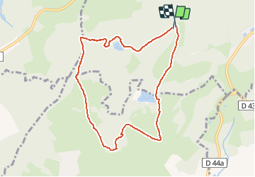

Length
8.4 km

Max alt
479 m

Uphill gradient
147 m
Km-Effort
10.3 km

Min alt
420 m

Downhill gradient
151 m
Boucle
Yes
Creation date :
2014-12-10 00:00:00.0
Updated on :
2014-12-10 00:00:00.0
2h17
Difficulty : Easy

FREE GPS app for hiking
 SityTrail
IGN / Geographical institutes
SityTrail Plus
The world is yours!
About
Trail Walking of 8.4 km to be discovered at Grand Est, Vosges, Épinal. This trail is proposed by jeanclaude12.
Description
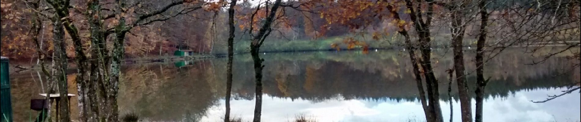
Belle randonnée d'automne près d'Épinal, aux Champs de Damas, passant par l'Etang du Riéfaing, la Curtillotte, le Fort des Friches, les Peureux et l'Etang du Bult.
Photos


Positioning
Country:
France
Region :
Grand Est
Department/Province :
Vosges
Municipality :
Épinal
Location:
Unknown
Start:(Dec)
Start:(UTM)
307806 ; 5334386 (32U) N.
Comments