


LE PERTHUS CASCADE AVION

FAUCET
User
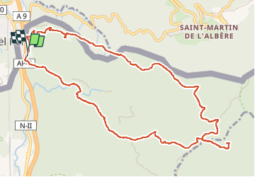

Length
13.8 km

Max alt
716 m

Uphill gradient
552 m
Km-Effort
21 km

Min alt
274 m

Downhill gradient
547 m
Boucle
Yes
Creation date :
2023-04-27 07:10:30.015
Updated on :
2023-04-27 12:41:32.82
3h54
Difficulty : Very difficult

FREE GPS app for hiking
 SityTrail
IGN / Geographical institutes
SityTrail Plus
The world is yours!
About
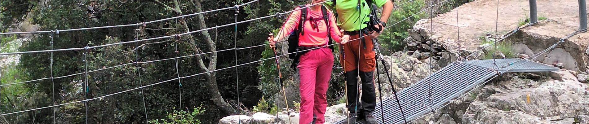
Trail Walking of 13.8 km to be discovered at Catalonia, Girona, la Jonquera. This trail is proposed by FAUCET.
Photos


Positioning
Country:
Spain
Region :
Catalonia
Department/Province :
Girona
Municipality :
la Jonquera
Location:
Unknown
Start:(Dec)
Start:(UTM)
489007 ; 4700925 (31T) N.
Comments