


parking Malvaux Ballon d'Alsace

taguette
User
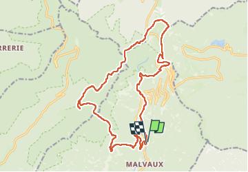

Length
21 km

Max alt
1245 m

Uphill gradient
850 m
Km-Effort
32 km

Min alt
589 m

Downhill gradient
852 m
Boucle
Yes
Creation date :
2023-04-27 06:55:54.755
Updated on :
2023-04-27 12:59:27.695
5h59
Difficulty : Difficult

FREE GPS app for hiking
 SityTrail
IGN / Geographical institutes
SityTrail Plus
The world is yours!
About
Trail Walking of 21 km to be discovered at Bourgogne-Franche-Comté, Territoire-de-Belfort, Lepuix. This trail is proposed by taguette.
Positioning
Country:
France
Region :
Bourgogne-Franche-Comté
Department/Province :
Territoire-de-Belfort
Municipality :
Lepuix
Location:
Unknown
Start:(Dec)
Start:(UTM)
337849 ; 5294584 (32T) N.
Comments