


GR58 Jour n°1

dudu79
User

Length
14.3 km

Max alt
2648 m

Uphill gradient
1103 m
Km-Effort
28 km

Min alt
1637 m

Downhill gradient
873 m
Boucle
No
Creation date :
2023-04-28 07:00:09.473
Updated on :
2023-04-28 07:01:38.009
6h24
Difficulty : Very difficult

FREE GPS app for hiking
 SityTrail
IGN / Geographical institutes
SityTrail Plus
The world is yours!
About
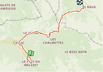
Trail Walking of 14.3 km to be discovered at Provence-Alpes-Côte d'Azur, Hautes-Alpes, Ceillac. This trail is proposed by dudu79.
Positioning
Country:
France
Region :
Provence-Alpes-Côte d'Azur
Department/Province :
Hautes-Alpes
Municipality :
Ceillac
Location:
Unknown
Start:(Dec)
Start:(UTM)
324629 ; 4946865 (32T) N.
Comments