


St_Germain_Herm_Bois_Moranges

jagarnier
User GUIDE
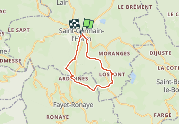

Length
9.7 km

Max alt
1118 m

Uphill gradient
295 m
Km-Effort
13.6 km

Min alt
962 m

Downhill gradient
297 m
Boucle
Yes
Creation date :
2023-04-28 15:00:24.994
Updated on :
2025-07-21 05:32:35.966
3h00
Difficulty : Medium

FREE GPS app for hiking
 SityTrail
IGN / Geographical institutes
SityTrail Plus
The world is yours!
About
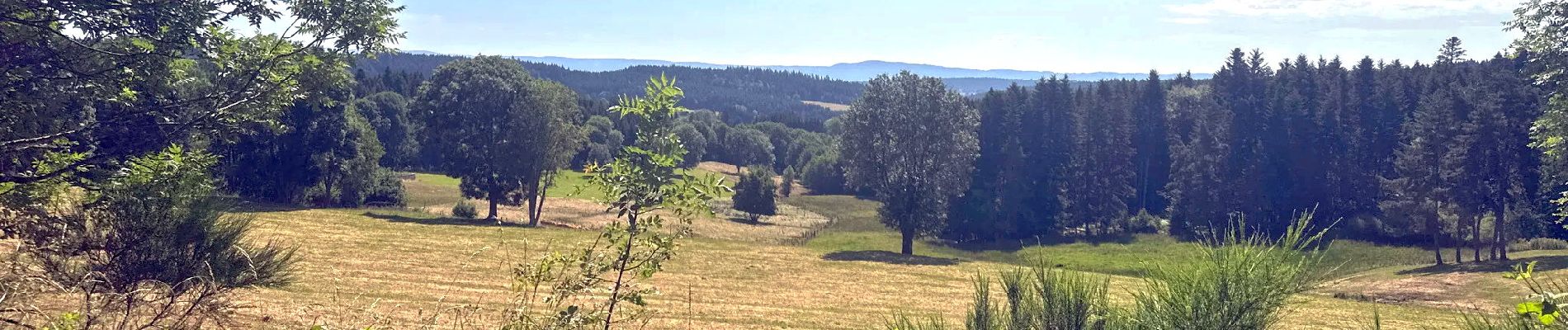
Trail Walking of 9.7 km to be discovered at Auvergne-Rhône-Alpes, Puy-de-Dôme, Saint-Germain-l'Herm. This trail is proposed by jagarnier.
Photos

Positioning
Country:
France
Region :
Auvergne-Rhône-Alpes
Department/Province :
Puy-de-Dôme
Municipality :
Saint-Germain-l'Herm
Location:
Unknown
Start:(Dec)
Start:(UTM)
542377 ; 5034028 (31T) N.
Comments