


Nant Cantobre Nant

jeff2
User
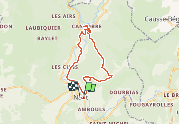

Length
15.3 km

Max alt
863 m

Uphill gradient
605 m
Km-Effort
23 km

Min alt
453 m

Downhill gradient
593 m
Boucle
Yes
Creation date :
2023-04-28 07:25:57.504
Updated on :
2023-04-28 15:23:52.35
7h01
Difficulty : Medium

FREE GPS app for hiking
 SityTrail
IGN / Geographical institutes
SityTrail Plus
The world is yours!
About
Trail Walking of 15.3 km to be discovered at Occitania, Aveyron, Nant. This trail is proposed by jeff2.
Description
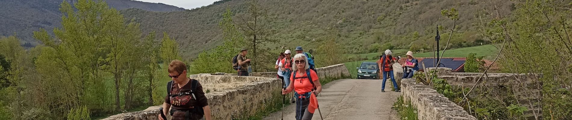
Belle montée à la fraîche, vue exceptionnelle, et descente sur Cantobre, déjeuner sur la place du village.
Retour tranquille.
Photos


31 photos in total. Please click on a photo to see them all in the gallery.
Positioning
Country:
France
Region :
Occitania
Department/Province :
Aveyron
Municipality :
Nant
Location:
Unknown
Start:(Dec)
Start:(UTM)
524308 ; 4874363 (31T) N.
Comments