


Montagne de Beaufayn

Clo0413
User
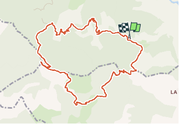

Length
13.5 km

Max alt
1243 m

Uphill gradient
766 m
Km-Effort
24 km

Min alt
504 m

Downhill gradient
768 m
Boucle
Yes
Creation date :
2023-04-30 06:53:41.631
Updated on :
2023-04-30 16:19:57.903
4h13
Difficulty : Medium

FREE GPS app for hiking
 SityTrail
IGN / Geographical institutes
SityTrail Plus
The world is yours!
About
Trail Walking of 13.5 km to be discovered at Auvergne-Rhône-Alpes, Drôme, Die. This trail is proposed by Clo0413.
Positioning
Country:
France
Region :
Auvergne-Rhône-Alpes
Department/Province :
Drôme
Municipality :
Die
Location:
Unknown
Start:(Dec)
Start:(UTM)
687954 ; 4954643 (31T) N.
Comments