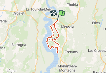
Trail Walking Coyron - Rando Vouglans - Photo
 albert39
albert39

User

© OpenStreetMap contributors
Length
Length
23 km
Max alt
Max alt
564 m
Uphill gradient
Uphill gradient
450 m
Km-Effort
Km-Effort  
29 km
Min alt
Min alt
428 m
Downhill gradient
Downhill gradient
450 m
Boucle
Boucle
Yes
Creation date :
2014-12-10 00:00:00.0
Updated on :
2014-12-10 00:00:00.0

(0 Reviews)

Walking
Walking
5h40
Difficulty : Easy

Scan this QR Code to open this trail in the SityTrail application

FREE GPS app for hiking

Logo SityTrail SityTrail

IGN / Geographical institutes

Download SityTrail from the App Store Download SityTrail from Google Play

Logo SityTrail SityTrail Plus

The world is yours!

Download SityTrail from the App Store Download SityTrail from Google Play Download SityTrail on Huawei AppGallery

About

Trail Walking of 23 km to be discovered at Bourgogne-Franche-Comté, Jura, Coyron. This trail is proposed by albert39.

Description

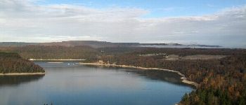
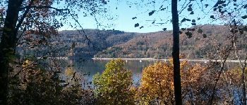
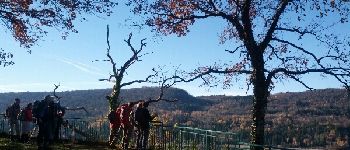
Sortie RSGD, groupe de 18, animateur Michel, facile et sympas. Belle journée ensoleillée.
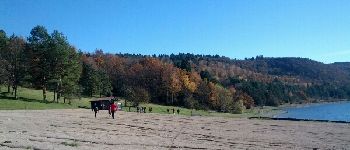
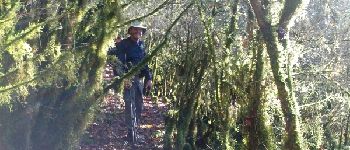
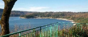
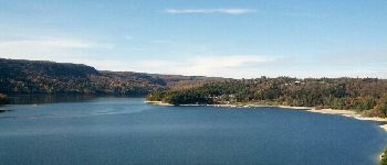
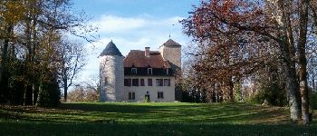
Elevation profile

Photos

Points of interest

Point of interest Coyron - Point 1 - Photo
albert39
COYRON 
Point of interest Maisod - Point 2 - Photo
albert39
MAISOD 
Point of interest Maisod - Point 3 - Photo
albert39
MAISOD 
Point of interest Maisod - Point 4 - Photo
albert39
MAISOD 
Point of interest Maisod - Point 5 - Photo
albert39
MAISOD 
Point of interest Maisod - Point 6 - Photo
albert39
MAISOD 
Point of interest Maisod - Point 7 - Photo
albert39
MAISOD 
Point of interest Maisod - Point 8 - Photo
albert39
MAISOD 
Point of interest Maisod - Point 9 - Photo
albert39
MAISOD 
Point of interest Maisod - Point 10 - Photo
albert39
MAISOD 

Positioning

Country:
France
Region :
Bourgogne-Franche-Comté
Department/Province :
Jura
Municipality :
Coyron
Location:
Unknown
Start:(UTM)
707392 ; 5154238 (31T) N.


Close
My subscriptions