Trail Walking Schalkenmehren - SityTrail - Schalkenmehren prévu - Photo
 danielf
danielf

User

© OpenStreetMap contributors
Length
Length
18.3 km
Max alt
Max alt
560 m
Uphill gradient
Uphill gradient
546 m
Km-Effort
Km-Effort  
26 km
Min alt
Min alt
352 m
Downhill gradient
Downhill gradient
546 m
Boucle
Boucle
Yes
Creation date :
2023-05-02 09:49:17.112
Updated on :
2023-05-02 09:53:34.227

(0 Reviews)

Walking
Walking
5h26
Difficulty : Medium

Scan this QR Code to open this trail in the SityTrail application

FREE GPS app for hiking

Logo SityTrail SityTrail

IGN / Geographical institutes

Download SityTrail from the App Store Download SityTrail from Google Play

Logo SityTrail SityTrail World

The world is yours!

Download SityTrail from the App Store Download SityTrail from Google Play Download SityTrail on Huawei AppGallery

About

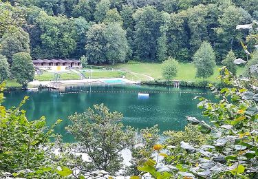
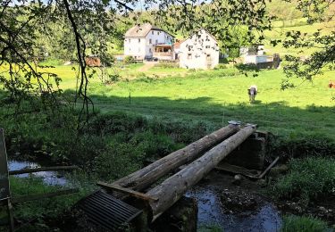
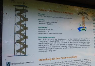
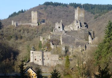
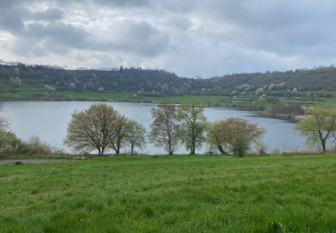
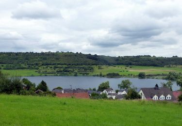
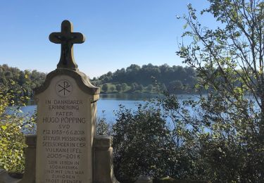
Trail Walking of 18.3 km to be discovered at Rhineland-Palatinate, Landkreis Vulkaneifel, Schalkenmehren. This trail is proposed by danielf.

Description

WE ULiège Sports 29-30/04-1/05/2023 - Jour 3

Elevation profile

Positioning

Country:
Germany
Region :
Rhineland-Palatinate
Department/Province :
Landkreis Vulkaneifel
Municipality :
Schalkenmehren
Location:
Unknown
Start:(UTM)
346637 ; 5559204 (32U) N.

Trails nearby

Trail On foot Daun - HeimatSpur Großer Dauner - Photo
On foot
PRO

On foot

Difficult
Daun, Rhineland-Palatinate, Landkreis Vulkaneifel, Germany
29 km | 40 km-effort
9h 0min
Yes
Trail On foot Üdersdorf - HeimatSpur Wasser- und Felsenweg - Photo
On foot
PRO

On foot

Easy
Üdersdorf, Rhineland-Palatinate, Landkreis Vulkaneifel, Germany
13.4 km | 18.2 km-effort
4h 8min
Yes
Trail On foot Steineberg - HeimatSpur Keltenrundweg - Photo
On foot
PRO

On foot

Medium
Steineberg, Rhineland-Palatinate, Landkreis Vulkaneifel, Germany
15.4 km | 20 km-effort
4h 36min
Yes
Trail On foot Schalkenmehren - HeimatSpur Maareglück - Photo
On foot
PRO

On foot

Easy
Schalkenmehren, Rhineland-Palatinate, Landkreis Vulkaneifel, Germany
10.8 km | 15.2 km-effort
3h 27min
Yes
Trail On foot Ellscheid - HeimatSpur Antoniusweg - Photo
On foot
PRO

On foot

Easy
Ellscheid, Rhineland-Palatinate, Landkreis Vulkaneifel, Germany
12 km | 15.1 km-effort
3h 25min
Yes
Trail On foot Schalkenmehren - Lieserpfad - Photo
On foot
PRO

On foot

Medium
Schalkenmehren, Rhineland-Palatinate, Landkreis Vulkaneifel, Germany
20 km | 27 km-effort
6h 14min
No
Trail Walking Daun - Les 3 Maars de Daun (Eifel) - Photo
Walking
dauzata

Walking

Easy
Daun, Rhineland-Palatinate, Landkreis Vulkaneifel, Germany
8.8 km | 12.5 km-effort
2h 50min
Yes
Trail On foot Schalkenmehren - Rundweg 3 - Photo
On foot
PRO

On foot

Easy
Schalkenmehren, Rhineland-Palatinate, Landkreis Vulkaneifel, Germany
3.9 km | 5 km-effort
1h 8min
Yes
Trail Walking Daun - Dauber Maare (PVDB) - Photo
Walking
GUIDE
Peter.vdbergh

Walking

Medium
Daun, Rhineland-Palatinate, Landkreis Vulkaneifel, Germany
9.5 km | 13.3 km-effort
3h 0min
Yes


Close
My subscriptions