


Départ Steenvoorde arrivée CampingLa ferme des Saules

jeff2
User
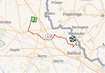

Length
28 km

Max alt
164 m

Uphill gradient
293 m
Km-Effort
32 km

Min alt
23 m

Downhill gradient
303 m
Boucle
No
Creation date :
2023-05-02 05:03:04.667
Updated on :
2023-05-02 15:17:04.134
8h47
Difficulty : Medium

FREE GPS app for hiking
 SityTrail
IGN / Geographical institutes
SityTrail Plus
The world is yours!
About
Trail Walking of 28 km to be discovered at Hauts-de-France, Nord, Steenvoorde. This trail is proposed by jeff2.
Description
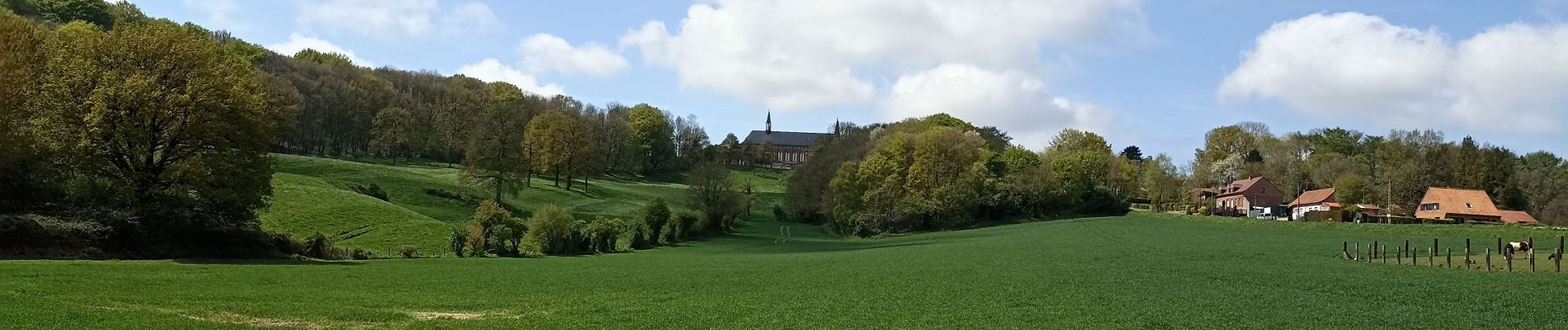
7H00 Départ du camping Le Romantic, puis passage à côté Steenvorde, Terdeghem, Eecke, Godewaersvelde, Abbaye au Mont des Cats, Berthen, Camping de la Ferme des Saules, à 3 kms de Bailleul.
Photos


Positioning
Country:
France
Region :
Hauts-de-France
Department/Province :
Nord
Municipality :
Steenvoorde
Location:
Unknown
Start:(Dec)
Start:(UTM)
466709 ; 5629921 (31U) N.
Comments