


mielandre par le pin

andrechauvin
User
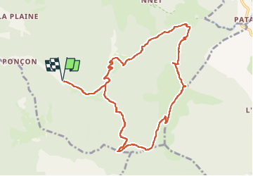

Length
11 km

Max alt
1443 m

Uphill gradient
806 m
Km-Effort
22 km

Min alt
681 m

Downhill gradient
806 m
Boucle
Yes
Creation date :
2023-05-02 06:50:13.434
Updated on :
2023-05-02 17:15:23.448
8h36
Difficulty : Difficult

FREE GPS app for hiking
 SityTrail
IGN / Geographical institutes
SityTrail Plus
The world is yours!
About
Trail Walking of 11 km to be discovered at Auvergne-Rhône-Alpes, Drôme, Vesc. This trail is proposed by andrechauvin.
Description
rando decouverte
Positioning
Country:
France
Region :
Auvergne-Rhône-Alpes
Department/Province :
Drôme
Municipality :
Vesc
Location:
Unknown
Start:(Dec)
Start:(UTM)
672286 ; 4928100 (31T) N.
Comments