


SityTrail - Etang la Ville

Rando MLC
User

Length
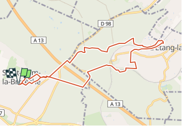
9.7 km

Max alt
187 m

Uphill gradient
176 m
Km-Effort
12.1 km

Min alt
105 m

Downhill gradient
176 m
Boucle
Yes
Creation date :
2023-05-05 16:32:24.881
Updated on :
2023-05-05 16:42:52.186
2h44
Difficulty : Medium

FREE GPS app for hiking
 SityTrail
IGN / Geographical institutes
SityTrail Plus
The world is yours!
About
Trail Walking of 9.7 km to be discovered at Ile-de-France, Yvelines, Saint-Nom-la-Bretèche. This trail is proposed by Rando MLC.
Positioning
Country:
France
Region :
Ile-de-France
Department/Province :
Yvelines
Municipality :
Saint-Nom-la-Bretèche
Location:
Unknown
Start:(Dec)
Start:(UTM)
428113 ; 5412630 (31U) N.
Comments