


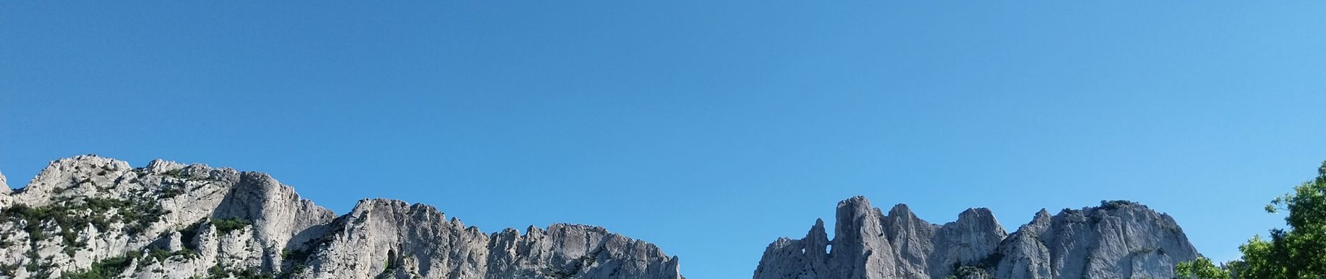
Les dentelles de Montmirail depuis Gigondas

randochu
User

Length
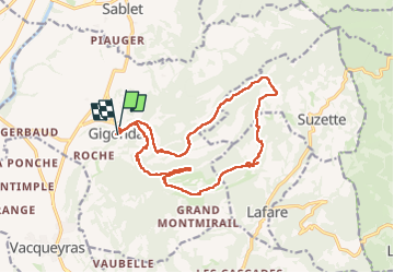
17.9 km

Max alt
584 m

Uphill gradient
777 m
Km-Effort
28 km

Min alt
232 m

Downhill gradient
766 m
Boucle
No
Creation date :
2023-05-04 07:04:31.412
Updated on :
2023-05-08 05:03:57.771
6h25
Difficulty : Medium

FREE GPS app for hiking
 SityTrail
IGN / Geographical institutes
SityTrail Plus
The world is yours!
About
Trail Walking of 17.9 km to be discovered at Provence-Alpes-Côte d'Azur, Vaucluse, Gigondas. This trail is proposed by randochu.
Description
Les dentelles par les sentiers
Photos


Positioning
Country:
France
Region :
Provence-Alpes-Côte d'Azur
Department/Province :
Vaucluse
Municipality :
Gigondas
Location:
Unknown
Start:(Dec)
Start:(UTM)
660331 ; 4892226 (31T) N.
Comments