


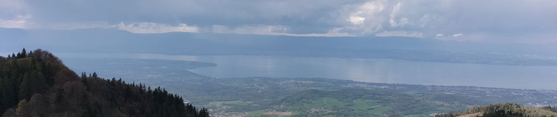
Le Mont Forchat au départ du col des Arses

reneperrin
User
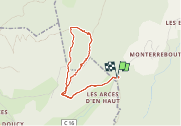

Length
4.2 km

Max alt
1520 m

Uphill gradient
351 m
Km-Effort
8.9 km

Min alt
1164 m

Downhill gradient
346 m
Boucle
Yes
Creation date :
2023-05-06 13:07:46.837
Updated on :
2023-05-06 15:50:32.058
1h20
Difficulty : Medium

FREE GPS app for hiking
 SityTrail
IGN / Geographical institutes
SityTrail Plus
The world is yours!
About
Trail Walking of 4.2 km to be discovered at Auvergne-Rhône-Alpes, Upper Savoy, Lullin. This trail is proposed by reneperrin.
Photos


Positioning
Country:
France
Region :
Auvergne-Rhône-Alpes
Department/Province :
Upper Savoy
Municipality :
Lullin
Location:
Unknown
Start:(Dec)
Start:(UTM)
306794 ; 5126964 (32T) N.
Comments