


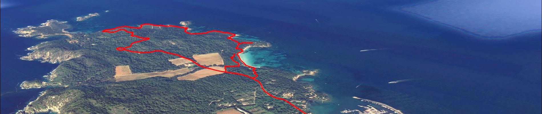
Ile de Porquerolles

affinetataille
User GUIDE
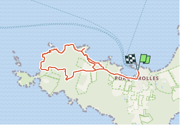

Length
9.4 km

Max alt
69 m

Uphill gradient
139 m
Km-Effort
11.3 km

Min alt
0 m

Downhill gradient
140 m
Boucle
Yes
Creation date :
2023-05-06 16:22:40.782
Updated on :
2023-05-08 09:32:06.12
3h00
Difficulty : Very easy

FREE GPS app for hiking
 SityTrail
IGN / Geographical institutes
SityTrail Plus
The world is yours!
About
Trail Walking of 9.4 km to be discovered at Provence-Alpes-Côte d'Azur, Var, Hyères. This trail is proposed by affinetataille.
Photos


23 photos in total. Please click on a photo to see them all in the gallery.
Positioning
Country:
France
Region :
Provence-Alpes-Côte d'Azur
Department/Province :
Var
Municipality :
Hyères
Location:
Unknown
Start:(Dec)
Start:(UTM)
272008 ; 4764858 (32T) N.
Comments