Trail Walking Rognes - Rognes virée dans les vignes sur le sentier des vignerons - Photo

Rognes virée dans les vignes sur le sentier des vignerons

 jll7513
jll7513

User

© OpenStreetMap contributors
Length
Length
11.1 km
Max alt
Max alt
334 m
Uphill gradient
Uphill gradient
226 m
Km-Effort
Km-Effort  
14.1 km
Min alt
Min alt
208 m
Downhill gradient
Downhill gradient
226 m
Boucle
Boucle
Yes
Creation date :
2023-05-07 06:32:34.0
Updated on :
2023-05-07 16:34:09.548

(0 Reviews)

Walking
Walking
3h12
Difficulty : Easy
Nordic walking
Nordic walking
2h30
Difficulty : Easy

Scan this QR Code to open this trail in the SityTrail application

FREE GPS app for hiking

Logo SityTrail SityTrail

IGN / Geographical institutes

Download SityTrail from the App Store Download SityTrail from Google Play

Logo SityTrail SityTrail World

The world is yours!

Download SityTrail from the App Store Download SityTrail from Google Play Download SityTrail on Huawei AppGallery

About

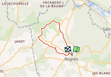
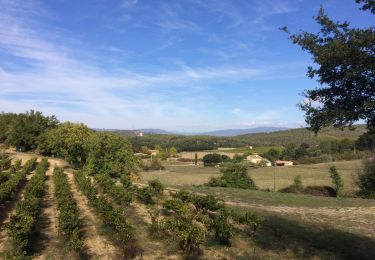
Trail Walking of 11.1 km to be discovered at Provence-Alpes-Côte d'Azur, Bouches-du-Rhône, Rognes. This trail is proposed by jll7513.

Description

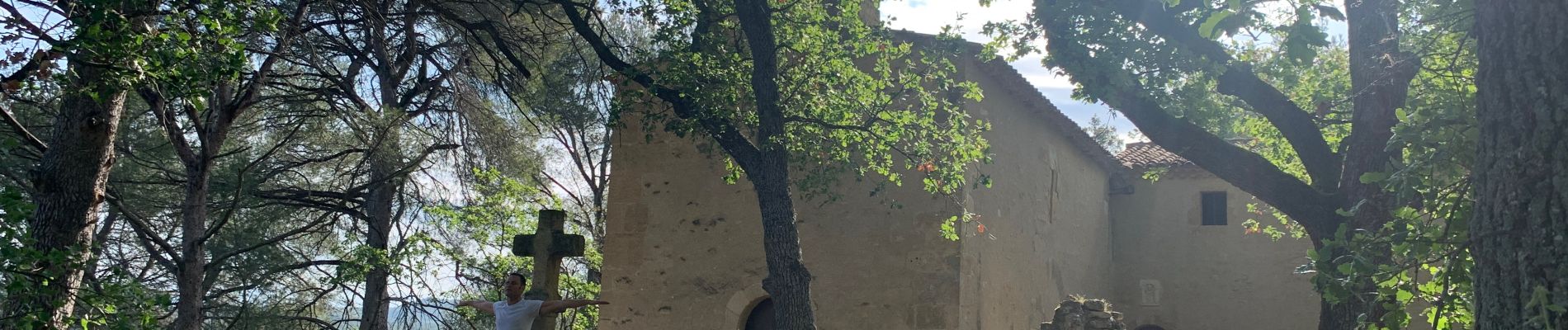
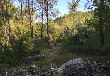
Stationnement dans Rognes sur un petit parking. 500 m de route pour rejoindre le sentier globalement bien ombragé.On passe par La Chapelle Saint Marcellin et on marche sur le contrefort des Costes.

Elevation profile

Photos

Positioning

Country:
France
Region :
Provence-Alpes-Côte d'Azur
Department/Province :
Bouches-du-Rhône
Municipality :
Rognes
Location:
Unknown
Start:(Dec)
Start:(UTM)
689294 ; 4837476 (31T) N.

Trails nearby

Trail Walking Saint-Cannat - PF-Saint-Cannat - Fontaine de Doudonne - PR  - Photo
Walking
MicDul

Walking

Medium
(1)
Saint-Cannat, Provence-Alpes-Côte d'Azur, Bouches-du-Rhône, France
6.9 km | 8.5 km-effort
2h 10min
Yes
Trail Walking Lambesc - GB LES JARDINS  - Photo
Walking
Ghislaine Blanchet

Walking

Medium
(3)
Lambesc, Provence-Alpes-Côte d'Azur, Bouches-du-Rhône, France
5.7 km | 6.6 km-effort
1h 30min
Yes
Trail Walking Rognes - Caire Val- les Costes -St Marcellin - Photo
Walking
Berpav

Walking

Medium
(1)
Rognes, Provence-Alpes-Côte d'Azur, Bouches-du-Rhône, France
8.6 km | 10.7 km-effort
2h 26min
Yes
Trail Walking La Roque-d'Anthéron - GB DURANCE+ CHÂTEAU DE JANSON  - Photo
Walking
Ghislaine Blanchet

Walking

Medium
La Roque-d'Anthéron, Provence-Alpes-Côte d'Azur, Bouches-du-Rhône, France
5.5 km | 6 km-effort
1h 22min
Yes
Trail Walking Rognes - St Christophe-La Durance-Ponserot - Photo
Walking

Walking

Difficult
(3)
Rognes, Provence-Alpes-Côte d'Azur, Bouches-du-Rhône, France
12.2 km | 14.4 km-effort
3h 14min
Yes
Trail Walking La Roque-d'Anthéron - PF-La Roque-d'Anthéron - Vallon de la Baume - Roques Menoures - Photo
Walking
MicDul

Walking

Easy
La Roque-d'Anthéron, Provence-Alpes-Côte d'Azur, Bouches-du-Rhône, France
7.8 km | 10.4 km-effort
1h 47min
No
Trail On foot Rognes - 13-AVR-14 15:19:15 - Photo
On foot
ARPF1

On foot

Medium
(1)
Rognes, Provence-Alpes-Côte d'Azur, Bouches-du-Rhône, France
16.4 km | 21 km-effort
Unknown
Yes
Trail On foot Saint-Cannat - Saint Cannat : autour de l'Etape - Photo
On foot
gabyschmidt

On foot

Easy
(1)
Saint-Cannat, Provence-Alpes-Côte d'Azur, Bouches-du-Rhône, France
11.1 km | 13.1 km-effort
Unknown
Yes
Trail Walking Rognes - mini sentier des vignerons  - Photo
Walking
patrickmays3

Walking

Easy
Rognes, Provence-Alpes-Côte d'Azur, Bouches-du-Rhône, France
10.5 km | 13.1 km-effort
2h 34min
Yes


Close
My subscriptions