


Balisage chemin des vignerons

ARPF
User
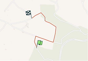

Length
1.1 km

Max alt
313 m

Uphill gradient
5 m
Km-Effort
1.3 km

Min alt
286 m

Downhill gradient
26 m
Boucle
No
Creation date :
2023-05-07 16:45:31.56
Updated on :
2023-05-07 16:55:59.104
17m
Difficulty : Easy

FREE GPS app for hiking
 SityTrail
IGN / Geographical institutes
SityTrail Plus
The world is yours!
About
Trail Walking of 1.1 km to be discovered at Provence-Alpes-Côte d'Azur, Bouches-du-Rhône, Trets. This trail is proposed by ARPF.

Positioning
Country:
France
Region :
Provence-Alpes-Côte d'Azur
Department/Province :
Bouches-du-Rhône
Municipality :
Trets
Location:
Unknown
Start:(Dec)
Start:(UTM)
720230 ; 4813756 (31T) N.
Comments