


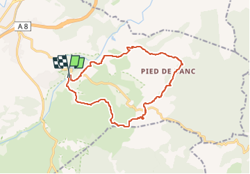
Vidauban - Cascade de l'Aille - Le Pommier

GSananes
User

Length
15.2 km

Max alt
227 m

Uphill gradient
363 m
Km-Effort
20 km

Min alt
36 m

Downhill gradient
360 m
Boucle
Yes
Creation date :
2023-05-07 17:08:40.248
Updated on :
2023-05-07 17:44:35.716
4h33
Difficulty : Medium

FREE GPS app for hiking
 SityTrail
IGN / Geographical institutes
SityTrail Plus
The world is yours!
About
Trail Walking of 15.2 km to be discovered at Provence-Alpes-Côte d'Azur, Var, Vidauban. This trail is proposed by GSananes.
Positioning
Country:
France
Region :
Provence-Alpes-Côte d'Azur
Department/Province :
Var
Municipality :
Vidauban
Location:
Unknown
Start:(Dec)
Start:(UTM)
293824 ; 4807907 (32T) N.
Comments