


Tour des Aiguiers-St Saturnin des Apt09-05-23

Christiancordin
User
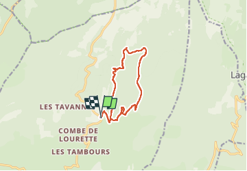

Length
12.1 km

Max alt
1048 m

Uphill gradient
434 m
Km-Effort
17.9 km

Min alt
729 m

Downhill gradient
434 m
Boucle
Yes
Creation date :
2023-05-09 07:37:26.09
Updated on :
2023-05-19 16:46:51.951
3h43
Difficulty : Medium

FREE GPS app for hiking
 SityTrail
IGN / Geographical institutes
SityTrail Plus
The world is yours!
About
Trail Walking of 12.1 km to be discovered at Provence-Alpes-Côte d'Azur, Vaucluse, Saint-Saturnin-lès-Apt. This trail is proposed by Christiancordin.
Description
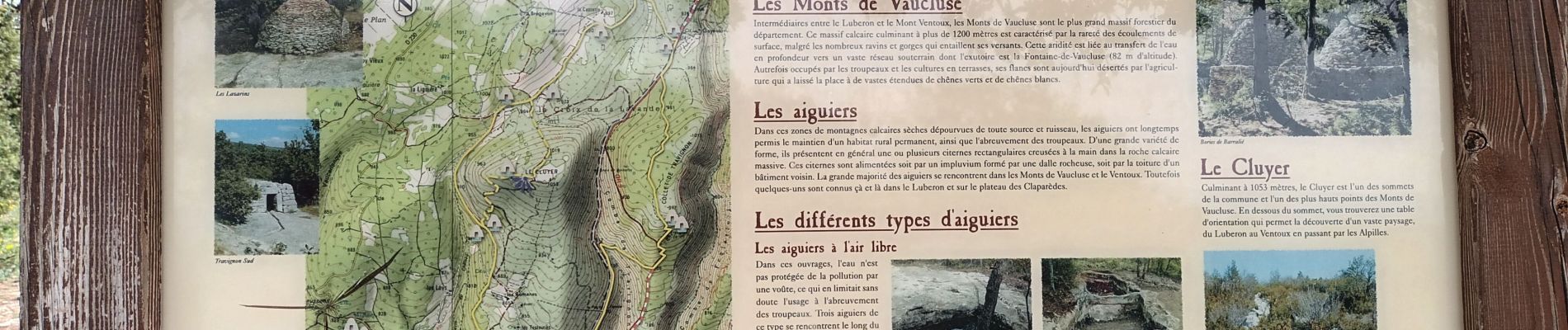
Pk les Longuets-Aiguiers Besson-Aiguier de Cluyer-la Cluyer-la croix de la lavande-piste des Lays-croix de Bonnefoy-la Boucane-Caulet.
Photos


Positioning
Country:
France
Region :
Provence-Alpes-Côte d'Azur
Department/Province :
Vaucluse
Municipality :
Saint-Saturnin-lès-Apt
Location:
Unknown
Start:(Dec)
Start:(UTM)
692048 ; 4871117 (31T) N.
Comments