


Le tour du chassezac

Roger Philippe Wallez
User GUIDE
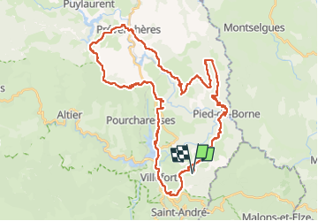

Length
49 km

Max alt
1085 m

Uphill gradient
1692 m
Km-Effort
72 km

Min alt
321 m

Downhill gradient
1693 m
Boucle
Yes
Creation date :
2023-05-07 07:36:28.0
Updated on :
2023-05-09 13:18:22.833
16h34
Difficulty : Very difficult

FREE GPS app for hiking
 SityTrail
IGN / Geographical institutes
SityTrail Plus
The world is yours!
About
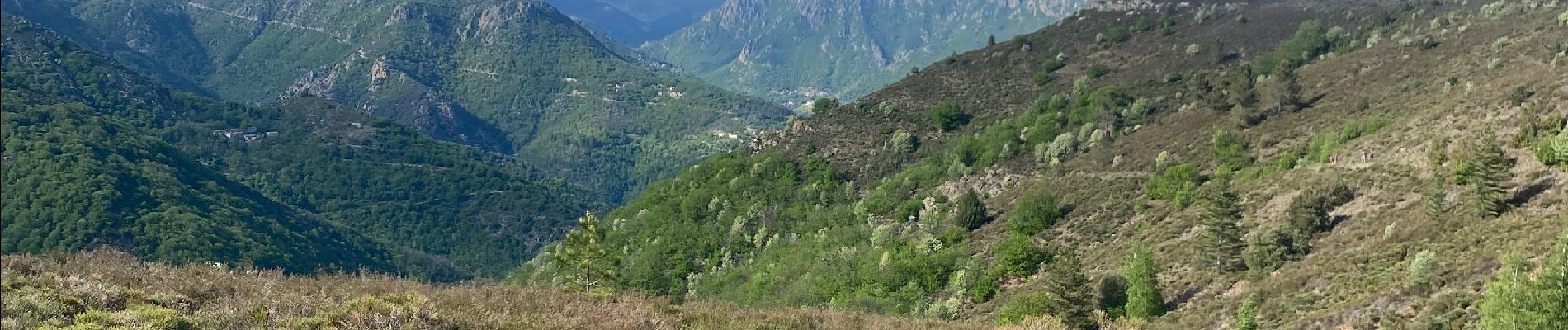
Trail Walking of 49 km to be discovered at Occitania, Lozère, Pied-de-Borne. This trail is proposed by Roger Philippe Wallez.
Photos


24 photos in total. Please click on a photo to see them all in the gallery.
Positioning
Country:
France
Region :
Occitania
Department/Province :
Lozère
Municipality :
Pied-de-Borne
Location:
Unknown
Start:(Dec)
Start:(UTM)
576295 ; 4921444 (31T) N.
Comments