


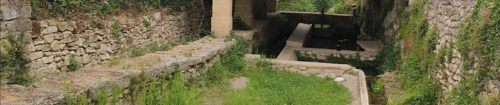
Sagries - Garrigues

rando30129
User
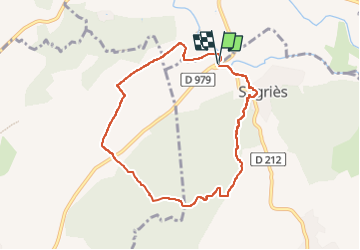

Length
8 km

Max alt
164 m

Uphill gradient
129 m
Km-Effort
9.8 km

Min alt
61 m

Downhill gradient
134 m
Boucle
Yes
Creation date :
2023-05-09 12:10:41.74
Updated on :
2023-05-15 14:07:52.376
2h13
Difficulty : Medium

FREE GPS app for hiking
 SityTrail
IGN / Geographical institutes
SityTrail Plus
The world is yours!
About
Trail Walking of 8 km to be discovered at Occitania, Gard, Sanilhac-Sagriès. This trail is proposed by rando30129.
Photos

Positioning
Country:
France
Region :
Occitania
Department/Province :
Gard
Municipality :
Sanilhac-Sagriès
Location:
Unknown
Start:(Dec)
Start:(UTM)
613218 ; 4870906 (31T) N.
Comments