


Orcival_Bois_Bourelles

jagarnier
User GUIDE
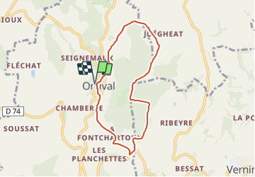

Length
6.9 km

Max alt
1066 m

Uphill gradient
239 m
Km-Effort
10.1 km

Min alt
870 m

Downhill gradient
238 m
Boucle
Yes
Creation date :
2023-05-10 12:20:49.314
Updated on :
2023-08-17 11:10:04.716
2h00
Difficulty : Easy

FREE GPS app for hiking
 SityTrail
IGN / Geographical institutes
SityTrail Plus
The world is yours!
About
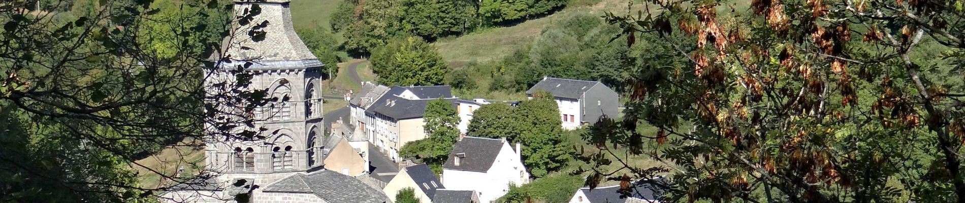
Trail Walking of 6.9 km to be discovered at Auvergne-Rhône-Alpes, Puy-de-Dôme, Orcival. This trail is proposed by jagarnier.
Description
Une randonnée agréable dans la fraîcheur du bois de Bourelles au départ d’Orcival et sa basilique.
Photos

Positioning
Country:
France
Region :
Auvergne-Rhône-Alpes
Department/Province :
Puy-de-Dôme
Municipality :
Orcival
Location:
Unknown
Start:(Dec)
Start:(UTM)
487668 ; 5058873 (31T) N.
Comments