


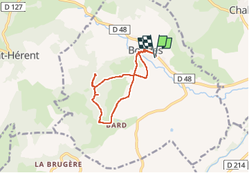
Vallée des Saints BOUDES

Papou63patrick
User

Length
6 km

Max alt
565 m

Uphill gradient
179 m
Km-Effort
8.4 km

Min alt
459 m

Downhill gradient
179 m
Boucle
Yes
Creation date :
2023-05-10 12:12:54.292
Updated on :
2023-05-10 15:03:31.052
1h48
Difficulty : Easy

FREE GPS app for hiking
 SityTrail
IGN / Geographical institutes
SityTrail Plus
The world is yours!
About
Trail Walking of 6 km to be discovered at Auvergne-Rhône-Alpes, Puy-de-Dôme, Boudes. This trail is proposed by Papou63patrick.
Photos


Positioning
Country:
France
Region :
Auvergne-Rhône-Alpes
Department/Province :
Puy-de-Dôme
Municipality :
Boudes
Location:
Unknown
Start:(Dec)
Start:(UTM)
514665 ; 5033783 (31T) N.
Comments