


Suisse Normande J2

lionelnottat
User

Length
20 km

Max alt
237 m

Uphill gradient
530 m
Km-Effort
27 km

Min alt
52 m

Downhill gradient
452 m
Boucle
No
Creation date :
2023-05-10 07:58:54.28
Updated on :
2023-05-10 15:24:49.878
5h25
Difficulty : Very difficult

FREE GPS app for hiking
 SityTrail
IGN / Geographical institutes
SityTrail Plus
The world is yours!
About
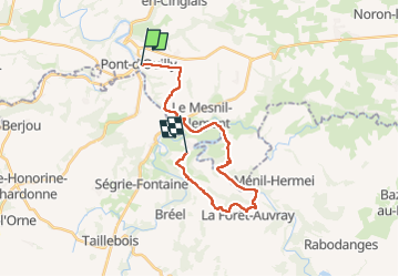
Trail Walking of 20 km to be discovered at Normandy, Calvados, Pont-d'Ouilly. This trail is proposed by lionelnottat.
Positioning
Country:
France
Region :
Normandy
Department/Province :
Calvados
Municipality :
Pont-d'Ouilly
Location:
Unknown
Start:(Dec)
Start:(UTM)
690064 ; 5416670 (30U) N.
Comments