


Belvédère de Pierre Arnoux en partant parking de Naudet force 2

damlou
User
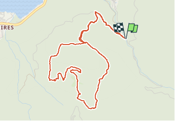

Length
6.5 km

Max alt
1300 m

Uphill gradient
393 m
Km-Effort
11.7 km

Min alt
900 m

Downhill gradient
392 m
Boucle
Yes
Creation date :
2023-05-12 07:17:47.406
Updated on :
2023-05-12 10:05:29.766
2h06
Difficulty : Medium

FREE GPS app for hiking
 SityTrail
IGN / Geographical institutes
SityTrail Plus
The world is yours!
About
Trail Walking of 6.5 km to be discovered at Provence-Alpes-Côte d'Azur, Hautes-Alpes, Savines-le-Lac. This trail is proposed by damlou.
Description
Départ parking du Naudet
Difficulté 2 entre départ Guillaine et départ Savines
Positioning
Country:
France
Region :
Provence-Alpes-Côte d'Azur
Department/Province :
Hautes-Alpes
Municipality :
Savines-le-Lac
Location:
Unknown
Start:(Dec)
Start:(UTM)
294038 ; 4932601 (32T) N.
Comments
Difficultés moyenne force 2 départ parking Naudet