


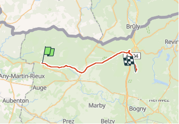
De Signy le Petit à Bourg Fidèle

jeff2
User


7h58
Difficulty : Difficult

FREE GPS app for hiking
 SityTrail
IGN / Geographical institutes
SityTrail Plus
The world is yours!
About
Trail Walking of 27 km to be discovered at Grand Est, Ardennes, Signy-le-Petit. This trail is proposed by jeff2.
Description
Matinée sous pluie battante, arrivée à Rocroi, trempés. Mairie de Rocroi pas accueillante du tout, c'est le cas de la majorité des personnes rencontrés.
A Bourg Fidèle, le Maire nous ouvre un vestiaire de stade, plus que simple, mais tellement mieux que sous tente, sous la pluie.
Photos


Positioning
Comments