


GR20 training 7

apa
User
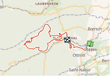

Length
19.8 km

Max alt
791 m

Uphill gradient
816 m
Km-Effort
30 km

Min alt
252 m

Downhill gradient
732 m
Boucle
No
Creation date :
2023-05-13 11:08:40.0
Updated on :
2023-05-13 16:20:21.01

FREE GPS app for hiking
 SityTrail
IGN / Geographical institutes
SityTrail Plus
The world is yours!
About
Trail of 19.8 km to be discovered at Grand Est, Bas-Rhin, Ottrott. This trail is proposed by apa.
Photos


Positioning
Country:
France
Region :
Grand Est
Department/Province :
Bas-Rhin
Municipality :
Ottrott
Location:
Unknown
Start:(Dec)
Start:(UTM)
384010 ; 5368660 (32U) N.
Comments