


Baugy - Digion

Shadowfax
User
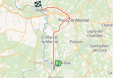

Length
33 km

Max alt
266 m

Uphill gradient
139 m
Km-Effort
35 km

Min alt
229 m

Downhill gradient
159 m
Boucle
No
Creation date :
2023-05-14 08:23:31.0
Updated on :
2023-05-14 08:23:33.11
0m
Difficulty : Unknown

FREE GPS app for hiking
 SityTrail
IGN / Geographical institutes
SityTrail Plus
The world is yours!
About
Trail Trail of 33 km to be discovered at Bourgogne-Franche-Comté, Saône-et-Loire, Baugy. This trail is proposed by Shadowfax.
Positioning
Country:
France
Region :
Bourgogne-Franche-Comté
Department/Province :
Saône-et-Loire
Municipality :
Baugy
Location:
Unknown
Start:(Dec)
Start:(UTM)
579290 ; 5127592 (31T) N.
Comments