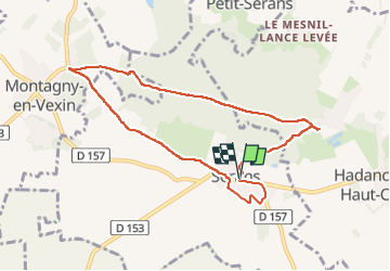
Trail Walking Serans - Chemin de Serans - Photo

Chemin de Serans

 Fky78
Fky78

User

© OpenStreetMap contributors
Length
Length
8.2 km
Max alt
Max alt
218 m
Uphill gradient
Uphill gradient
129 m
Km-Effort
Km-Effort  
9.9 km
Min alt
Min alt
120 m
Downhill gradient
Downhill gradient
133 m
Boucle
Boucle
Yes
Creation date :
2023-05-16 12:15:44.56
Updated on :
2023-05-16 16:41:44.432

(0 Reviews)

Walking
Walking
2h14
Difficulty : Medium

Scan this QR Code to open this trail in the SityTrail application

FREE GPS app for hiking

Logo SityTrail SityTrail

IGN / Geographical institutes

Download SityTrail from the App Store Download SityTrail from Google Play

Logo SityTrail SityTrail Plus

The world is yours!

Download SityTrail from the App Store Download SityTrail from Google Play Download SityTrail on Huawei AppGallery

About

Trail Walking of 8.2 km to be discovered at Hauts-de-France, Oise, Serans. This trail is proposed by Fky78.

Description

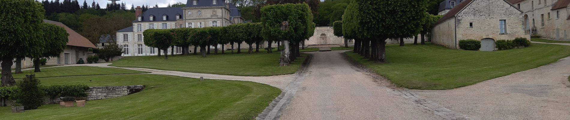
Parcours  entre forêt et vue sur grandes plaines , on peut voir la tour Eiffel au loin par temps clair , passage dans la forêt humide et boueux ce printemps et haute herbe dans la fin du chemin avant retour sur Serans

Elevation profile

Photos

Positioning

Country:
France
Region :
Hauts-de-France
Department/Province :
Oise
Municipality :
Serans
Location:
Unknown
Start:(UTM)
414889 ; 5448834 (31U) N.


Close
My subscriptions