


casini

bouscaillou
User
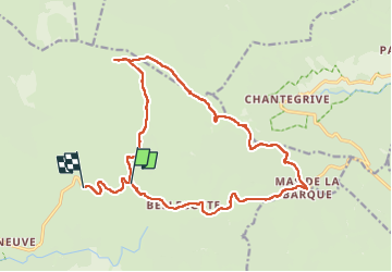

Length
20 km

Max alt
1678 m

Uphill gradient
452 m
Km-Effort
26 km

Min alt
1348 m

Downhill gradient
434 m
Boucle
No
Creation date :
2023-05-14 07:46:02.482
Updated on :
2023-05-17 08:25:24.732
7h15
Difficulty : Very difficult

FREE GPS app for hiking
 SityTrail
IGN / Geographical institutes
SityTrail Plus
The world is yours!
About
Trail Walking of 20 km to be discovered at Occitania, Lozère, Pont de Montvert - Sud Mont Lozère. This trail is proposed by bouscaillou.
Positioning
Country:
France
Region :
Occitania
Department/Province :
Lozère
Municipality :
Pont de Montvert - Sud Mont Lozère
Location:
Le Pont-de-Montvert
Start:(Dec)
Start:(UTM)
565272 ; 4915207 (31T) N.
Comments