


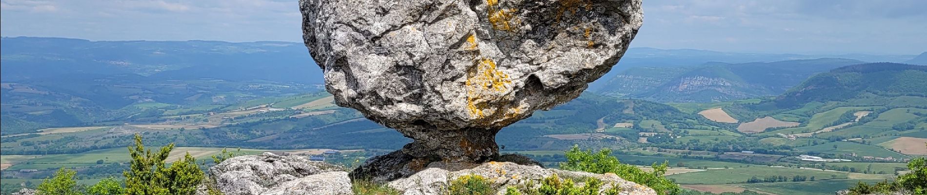
le rocher de Roucangel

amiral13
User GUIDE
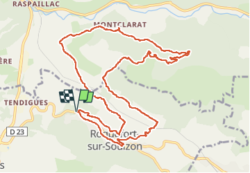

Length
14.1 km

Max alt
787 m

Uphill gradient
572 m
Km-Effort
22 km

Min alt
437 m

Downhill gradient
572 m
Boucle
Yes
Creation date :
2023-05-19 08:19:46.238
Updated on :
2023-05-22 07:12:44.741
6h43
Difficulty : Easy

FREE GPS app for hiking
 SityTrail
IGN / Geographical institutes
SityTrail Plus
The world is yours!
About
Trail Walking of 14.1 km to be discovered at Occitania, Aveyron, Roquefort-sur-Soulzon. This trail is proposed by amiral13.
Description
Randonnée effectuée le 19 mai 2023
Photos


23 photos in total. Please click on a photo to see them all in the gallery.
Positioning
Country:
France
Region :
Occitania
Department/Province :
Aveyron
Municipality :
Roquefort-sur-Soulzon
Location:
Unknown
Start:(Dec)
Start:(UTM)
498487 ; 4869785 (31T) N.
Comments