


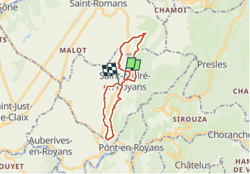
Circuite en 8 autour de Saint-André-en-Royans

Emelle
User

Length
12.1 km

Max alt
447 m

Uphill gradient
241 m
Km-Effort
15.4 km

Min alt
264 m

Downhill gradient
270 m
Boucle
No
Creation date :
2023-05-20 09:54:19.497
Updated on :
2023-05-25 15:25:48.034
3h03
Difficulty : Easy

FREE GPS app for hiking
 SityTrail
IGN / Geographical institutes
SityTrail Plus
The world is yours!
About
Trail Nordic walking of 12.1 km to be discovered at Auvergne-Rhône-Alpes, Isère, Saint-André-en-Royans. This trail is proposed by Emelle.
Description
MN agréable et campagnarde faite après la visite commentée le matin du village de Saint André-en-Royans par l'association "Les amis du Vieux Saint-André"
Photos


Positioning
Country:
France
Region :
Auvergne-Rhône-Alpes
Department/Province :
Isère
Municipality :
Saint-André-en-Royans
Location:
Unknown
Start:(Dec)
Start:(UTM)
684069 ; 4995154 (31T) N.
Comments