


Chapelle Saint Gabriel

Roger Philippe Wallez
User GUIDE
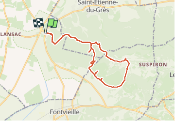

Length
18.6 km

Max alt
204 m

Uphill gradient
460 m
Km-Effort
25 km

Min alt
12 m

Downhill gradient
461 m
Boucle
Yes
Creation date :
2023-05-20 08:08:40.0
Updated on :
2023-05-21 05:11:20.475
5h23
Difficulty : Very difficult

FREE GPS app for hiking
 SityTrail
IGN / Geographical institutes
SityTrail Plus
The world is yours!
About
Trail Walking of 18.6 km to be discovered at Provence-Alpes-Côte d'Azur, Bouches-du-Rhône, Tarascon. This trail is proposed by Roger Philippe Wallez.
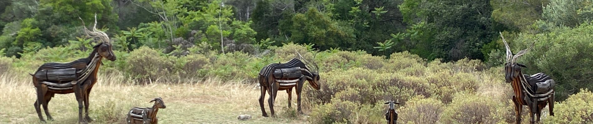
Photos


Positioning
Country:
France
Region :
Provence-Alpes-Côte d'Azur
Department/Province :
Bouches-du-Rhône
Municipality :
Tarascon
Location:
Unknown
Start:(Dec)
Start:(UTM)
636375 ; 4847305 (31T) N.
Comments