


prisches

brunobuj
User
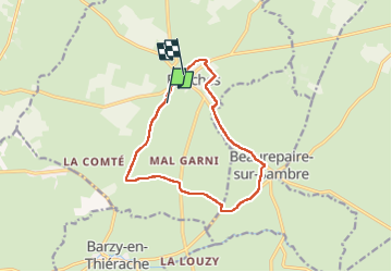

Length
12 km

Max alt
203 m

Uphill gradient
86 m
Km-Effort
13.2 km

Min alt
168 m

Downhill gradient
84 m
Boucle
No
Creation date :
2023-05-21 06:55:29.951
Updated on :
2023-05-21 09:34:01.187
2h37
Difficulty : Difficult

FREE GPS app for hiking
 SityTrail
IGN / Geographical institutes
SityTrail Plus
The world is yours!
About
Trail Walking of 12 km to be discovered at Hauts-de-France, Nord, Prisches. This trail is proposed by brunobuj.
Positioning
Country:
France
Region :
Hauts-de-France
Department/Province :
Nord
Municipality :
Prisches
Location:
Unknown
Start:(Dec)
Start:(UTM)
554573 ; 5547217 (31U) N.
Comments