


crêtes des Charmilles 21 05 2023

bymarc26
User
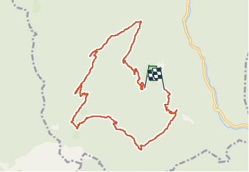

Length
10.7 km

Max alt
1645 m

Uphill gradient
739 m
Km-Effort
21 km

Min alt
865 m

Downhill gradient
805 m
Boucle
No
Creation date :
2023-05-21 07:33:48.183
Updated on :
2023-05-21 12:43:07.807
3h44
Difficulty : Difficult

FREE GPS app for hiking
 SityTrail
IGN / Geographical institutes
SityTrail Plus
The world is yours!
About
Trail Walking of 10.7 km to be discovered at Auvergne-Rhône-Alpes, Isère, Saint-Laurent-du-Pont. This trail is proposed by bymarc26.
Description
Attention au terrain glissant
Classé pour cette raison en difficile
Photos

Positioning
Country:
France
Region :
Auvergne-Rhône-Alpes
Department/Province :
Isère
Municipality :
Saint-Laurent-du-Pont
Location:
Unknown
Start:(Dec)
Start:(UTM)
714549 ; 5026421 (31T) N.
Comments