


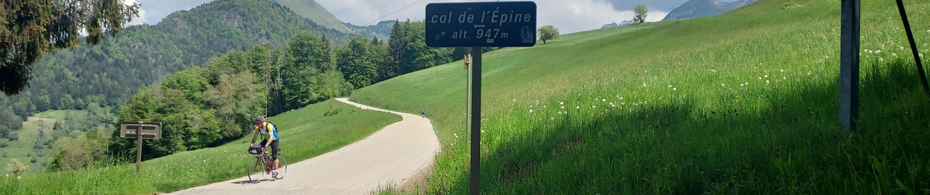
REALISE P1 Col de l'Epine-La Tournette

Specialized77
User GUIDE
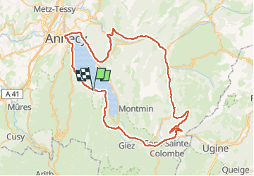

Length
79 km

Max alt
988 m

Uphill gradient
1298 m
Km-Effort
97 km

Min alt
445 m

Downhill gradient
1301 m
Boucle
Yes
Creation date :
2023-05-22 07:12:45.907
Updated on :
2023-05-25 08:21:18.749
5h32
Difficulty : Difficult

FREE GPS app for hiking
 SityTrail
IGN / Geographical institutes
SityTrail Plus
The world is yours!
About
Trail Road bike of 79 km to be discovered at Auvergne-Rhône-Alpes, Upper Savoy, Saint-Jorioz. This trail is proposed by Specialized77.
Photos


Positioning
Country:
France
Region :
Auvergne-Rhône-Alpes
Department/Province :
Upper Savoy
Municipality :
Saint-Jorioz
Location:
Unknown
Start:(Dec)
Start:(UTM)
281227 ; 5078722 (32T) N.
Comments