


Saint léger

veroberton
User

Length
11.8 km

Max alt
350 m

Uphill gradient
226 m
Km-Effort
14.9 km

Min alt
266 m

Downhill gradient
226 m
Boucle
Yes
Creation date :
2023-05-22 12:46:35.32
Updated on :
2023-05-22 16:03:32.394
3h15
Difficulty : Easy

FREE GPS app for hiking
 SityTrail
IGN / Geographical institutes
SityTrail Plus
The world is yours!
About
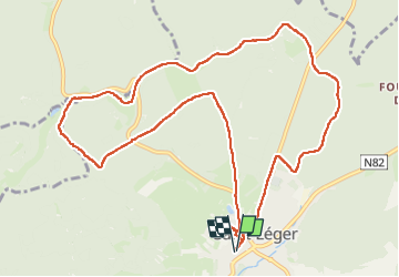
Trail Walking of 11.8 km to be discovered at Wallonia, Luxembourg, Saint-Léger. This trail is proposed by veroberton.
Positioning
Country:
Belgium
Region :
Wallonia
Department/Province :
Luxembourg
Municipality :
Saint-Léger
Location:
Saint-Léger
Start:(Dec)
Start:(UTM)
691725 ; 5498833 (31U) N.
Comments