Trail On foot Schwindratzheim - de schwin en passant par schaffhouse et Mutzenhouse - Photo

de schwin en passant par schaffhouse et Mutzenhouse

 Vince120
Vince120

User

© OpenStreetMap contributors
Length
Length
10 km
Max alt
Max alt
244 m
Uphill gradient
Uphill gradient
143 m
Km-Effort
Km-Effort  
11.9 km
Min alt
Min alt
150 m
Downhill gradient
Downhill gradient
143 m
Boucle
Boucle
Yes
Creation date :
2023-05-23 09:57:03.881
Updated on :
2023-05-23 10:04:33.444

(0 Reviews)

On foot
On foot
2h42
Difficulty : Easy

Scan this QR Code to open this trail in the SityTrail application

FREE GPS app for hiking

Logo SityTrail SityTrail

IGN / Geographical institutes

Download SityTrail from the App Store Download SityTrail from Google Play

Logo SityTrail SityTrail World

The world is yours!

Download SityTrail from the App Store Download SityTrail from Google Play Download SityTrail on Huawei AppGallery

About

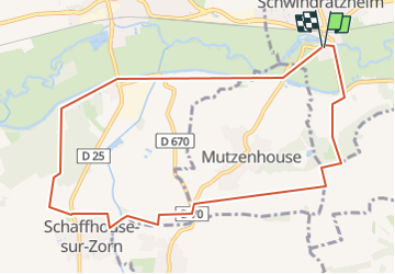
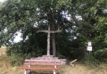
Trail On foot of 10 km to be discovered at Grand Est, Bas-Rhin, Schwindratzheim. This trail is proposed by Vince120.

Description

Départ salle polyvalente de SCHWINDRATZHEIM.
Montée sur le port de Hochfelden par le chemin de halage.
suivre le chemin de la forêt puis traverser la forêt de Schaffhouse.
A la sortie , descente vers le stade du Ramsberg  , direction Schaffhouse. Ensuite , sortie vers Hohfrankenheim  , au pont , prendre chemin du Scherolmenweg direction déchèterie.
Prendre le chemin rural vers le chateau d'eau puis descendre le Gipsbueckel vers le canal.
Revenir par la route vers le stade JJ Dutt puis arrivée salle polyvalente

Elevation profile

Positioning

Country:
France
Region :
Grand Est
Department/Province :
Bas-Rhin
Municipality :
Schwindratzheim
Location:
Unknown
Start:(UTM)
397120 ; 5400851 (32U) N.

Trails nearby

Trail Walking Wingersheim les Quatre Bans - 2024-01-01 - Photo
Walking
milou1941

Walking

Easy
Wingersheim les Quatre Bans, Grand Est, Bas-Rhin, France
4.6 km | 5.8 km-effort
2h 27min
Yes
Trail On foot Wingersheim les Quatre Bans - Sentier de découverte du houblon - Photo
On foot
PRO

On foot

Easy
Wingersheim les Quatre Bans, Grand Est, Bas-Rhin, France
4.6 km | 5.9 km-effort
1h 19min
Yes
Trail Walking Mommenheim - La plus moche forêt d'Alsace ! - Photo
Walking
sgazaix

Walking

Very easy
Mommenheim, Grand Est, Bas-Rhin, France
917 m | 1 km-effort
18min
No
Trail Walking Hochfelden - 2020-08-23 Le peuplier noir de Hochfelden - Photo
Walking
milou1941

Walking

Very easy
Hochfelden, Grand Est, Bas-Rhin, France
5.2 km | 5.6 km-effort
2h 6min
Yes
Trail Walking Wingersheim les Quatre Bans - routine 2 - Photo
Walking
sgazaix

Walking

Very easy
Wingersheim les Quatre Bans, Grand Est, Bas-Rhin, France
10 km | 10.9 km-effort
3h 34min
Yes
Trail Walking Waltenheim-sur-Zorn - Marche 4 - Photo
Walking
momo4612

Walking

Easy
Waltenheim-sur-Zorn, Grand Est, Bas-Rhin, France
6.8 km | 8.6 km-effort
1h 51min
No
Trail Walking Hohfrankenheim - Marche 3 - Photo
Walking
momo4612

Walking

Easy
Hohfrankenheim, Grand Est, Bas-Rhin, France
5 km | 6 km-effort
1h 20min
No
Trail Walking Schwindratzheim - Marche 2 - Photo
Walking
momo4612

Walking

Easy
Schwindratzheim, Grand Est, Bas-Rhin, France
5.4 km | 6.7 km-effort
1h 33min
No
Trail Walking Hochfelden - Marche 1 - Photo
Walking
momo4612

Walking

Easy
Hochfelden, Grand Est, Bas-Rhin, France
3.9 km | 4.7 km-effort
1h 9min
No


Close
My subscriptions